Satellite Tracking Study Aims To Unlock More Red Drum Secrets
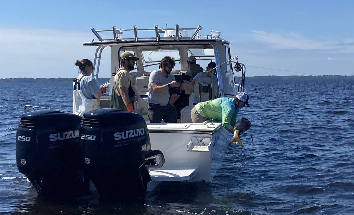
A pilot study tracking a popular saltwater fish was not expected to yield as much information as it did in its first year.
When the North Carolina Division of Marine Fisheries and its nonprofit project partner, the North Carolina Marine and Estuary Foundation, launched its red drum study last year, researchers thought the pop-off point where a satellite tag detached from a fish would be the most important piece of information they would glean.
Even over a short period of tracking time, they got much more.
“We wanted to use year one to learn and be prepared to expand it in year two,” said Cara Kowalchyk, red drum project lead biologist with the division. “We got more data than we originally anticipated. That’s allowed us to expand the project in many ways and the amount of data moving forward can corroborate what we saw in year one. We’ve got a strong, expanded plan moving into year two.
” Last October, the division tagged 10 mature red drum, or those that stretch more than 32 inches long, during its annual longline red drum survey in the Pamlico Sound.
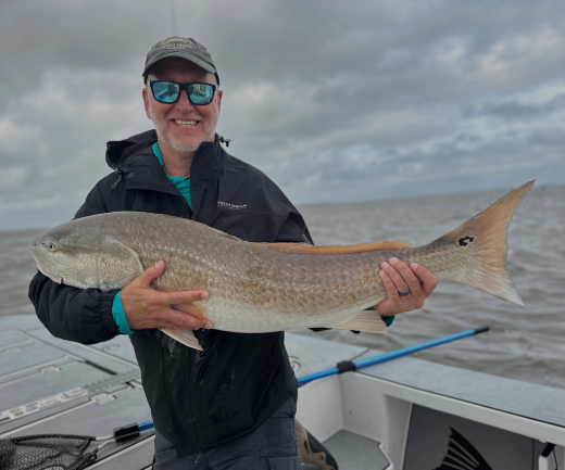
The tagging is part of a study aimed at unlocking some of the unknowns of one of the more popular recreational catches in North Carolina. While red drum studies are not new, there are gaps of information research has yet to fill.
One of the focuses of this project is to track areas in which adult red drum gather to spawn and where they head after they reproduce.
“We know when they come into our areas, but we are not as familiar with when they leave, do they all leave at once? Where do they go? Do they stay offshore during that whole time period? We’re looking at the post-spawning movements to fill that data gap,” Kowalchyk said.
Preliminary information collected from the satellite tags last year show regular movement between inshore and offshore waters.

“What we’ve seen from some of the fish is that they are moving out of the sound into the nearshore ocean,” said Marine and Estuary Foundation Executive Director Chad Thomas.
Other fish tracked last year traveled as far as 25 miles offshore, he said.
The foundation has posted on its website a promotional video that highlights the pilot project.
The solar-powered SeaTag-GEO pop-up satellite tag affixed to each fish last year provided multiple daily positioning coordinates of those fish by sending transmissions to the Argos satellite. The information is then shot from the satellite to computer software. The tags, created by marine technology manufacturer Desert Star Systems, can be programmed to stay attached to the fish for various durations of time.
Once a tag pops off, it floats on the water’s surface, where it collects additional information, such as water temperature and depth.
“The next major step is mining that data, filtering that data and trying to really tell the story on each fish and what it’s doing,” Thomas said.
That story, he said, is crucial in helping future management of red drum, which is the official state saltwater fish, and a species important to the state’s coastal economy.
“It’s a huge economic driver for our coast,” Thomas said.
The foundation approached the division in 2023 with the idea to use satellite technology to learn more about red drum.
The nonprofit has covered the cost of each tag, which run more than $1,000 each, and a $65 per tag, monthly subscription required to transmit recorded data from the tag to the software.
This year, 40 tags will be deployed under the pilot program.
Kowalchyk said Thomas will begin training this month how to attach a tag to a red drum using the top tagging method where the tag is affixed to the dorsal area of a fish.
The division agreed to help connect Thomas with local recreational fishing guides along the coast from Manteo to Wilmington to take him to areas where red drum can be caught, tagged, and released.
Thomas will be responsible for attaching 20 tags. The division will attach the other 20 during its survey later this year, Kowalchyk said, adding that she anticipates all 40 tags to be attached to red drum by October.
While a handful of tags will be programmed to remain on red drum for three months, the remainder will be set to pop off after a year, she said.
“We are going to double our effort and our data thanks to (the foundation) in year two,” Kowalchyk said. “I look forward to continuing that partnership. This is completely new. This is a novel project for both of us and it was a great, great learning year and we feel really strong and prepared for year two.”
By
Read more at Coastal Review, coastalreview.org.
You may be interested

Cold Water, Hot Bite: Late Fall Inshore Fishing in the Carolinas
Tim Wilson - October 30, 2026Every November there’s a morning when the air bites differently. The marsh grass has gone gold, the mullet are gone, and the water is clear enough to…

Three Ways to Make Your Offshore Trip Count
Tim Wilson - October 30, 2026Four hours of trolling without a strike can make an offshore fishing crew start watching the clock. You have already made the run, burned the fuel, and…
What Harvest Data Can Tell You About Deer Hunting
Tim Wilson - October 30, 2026How many times do you head to the woods before you get a shot at a deer? Most hunters have never counted, but state wildlife agencies have.…
Most from this category